
The images are from the CPC. Brown is below normal precipitation. Green is above normal precipitation. Blue is below normal temperatures. Red is above normal temperatures.
Below is the precipitation for the next 6-10 days.
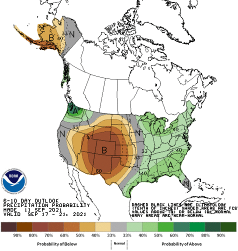 In the above image, I totally agree with the forecast, as the models have been showing lingering high pressure over the Plains. The below image is the 6-10 day forecast for temperatures.
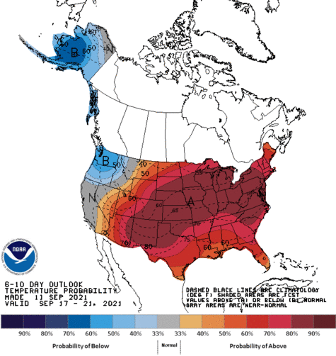 For the above forecast, I would pull away the big warm sector, since the high pressures over the Plains are from Canada and the Arctic. Below is the 8-14 day forecast for temperatures.
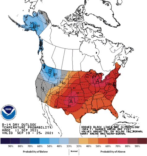
I would be OK with this, as some storms come through the area, Gulf air will be pulled up, bringing warm temperatures. Below is the 8-14 day forecast for precipitation.
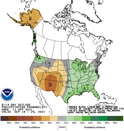
I do agree with this, as the models are showing clippers come through the Great Lakes and Upper Midwest.
No comments:
Post a Comment